| Entry Page | Getting There | Topo Maps | Day Packs | Duffels |
| Bathing, Toilets & Hygiene | Water | Bugs | Blisters | First Aid & Medical Emergencies |
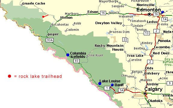
Getting to the Trailhead:
Travel time from Hinton to the Willmore Trailhead is about 1.5 hours on paved Hwy 40 & 30 km [20 miles] on a gravel road.
If you're coming from Edmonton, drive to Hinton [which is on the main highway 16 between Edmonton and Jasper] and then about take hwy 40 North at the west end of Hinton just out of town. Hwy 40 goes to Grande Cache.
If you're coming from Calgary, Banff, Jasper, drive almost into Hinton, look for Highway 40 on the left as you are nearing Hinton. If you get to Hinton, you've gone too far.
As you leave Hinton on paved hwy 40, you will first cross the Athabasca River Bridge, then later the small Wildhay River Bridge. About 5 km beyond the Wildhay bridge, you will left turn onto the gravel road to Rock Lake.
Getting from Hinton to the trailhead: allow for 1.5 hours.
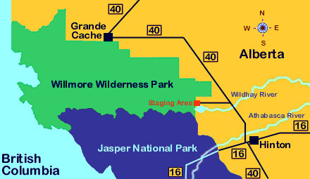
Details of roads near Rock Lake. Willmore signs will show you the way. Note the campgronds around Rock Lake.
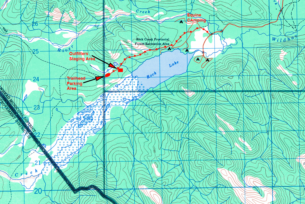
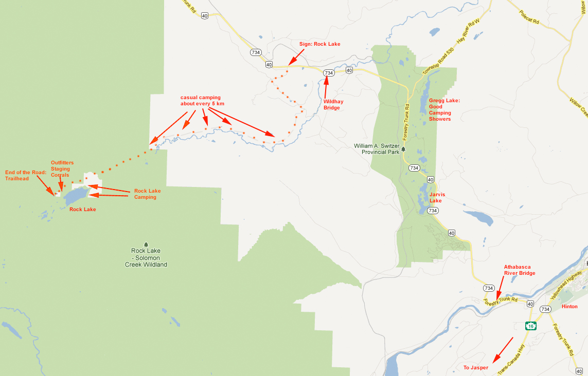
It's about 30 km to Rock Lake and the Trailhead on the gravel road which is not straight as depicted on the maps above. Follow signs to Rock Lake and then when you're near Rock Lake, you'll start seeing signs for Willmore Wilderness Park.
Within a few km of the start of the gravel road, you will reach a T-intersection. Go left. Shortly afterwards, within a few km, you will reach a choice of straight ahead or a right hand turn. Go right. Don't worry if you miss this. If you go straight, you'll drop down to a campground on a dead end road. The road continues along with some views of the Wildhay River and with several dirt roads going left. These all lead to casual campsites that you can use without reservations.
As you near Rock Lake, you will see Willmore Wilderness Park signs for right hand forks of the road. These forks will take you to the trailhead which has a parking lot and the usual trailhead map board. If you get to the Rock Lake Campground or Boat Launch, you are quite close, but likely missed the Willmore signs. Just backtrack a mile or so and you'll find them. The trailhead is NOT at the Rock Lake Campground.
Detailed Instructions: THESE DISTANCES ARE APPROXIMATE; a few may be off.
A few km West of Hinton, you'll find a turnof North for Hwy 40 going to Grande Cache. This is the road to take. From the turnoff here are distances to signs/places/bridges en route to the trailhead. I'm providing this much detail just so that you can feel reassured that you are on your way to the right place. One you get to the KEY TURN OFF at KM 38.6, the signs are very small and the dirt roads can be quite confusing. All distances in Kilometers.
0.0 Intersection of Hwy 16 [Jasper - Hinton - Edmonton] and Hwy 40 [Hinton to Grande Cache].
3.0 Sign for Entrance [left side: don't turn left!]
4.5 Bridge over the Athabasca River
5.7 Sign for Brule [left side: don't turn left]
7.1 Sign for Entrance Ranch [right side]
13.6 Park Information Bulletin Board [right side]
14.7 Pine Bay/Jarvis lake
19.1 Kelly's Bathtub
19.6 Venture Escape [on right ... a good place to stay]
23.0 Cache Lake
25.2 Gregg Lake [good camping; showers]
26.9 Hay River Road
34.6 Wildhay River Bridge [we cross the Wildhay on foot nearer the headwaters ... it's not as big as what's flowing beneath the bridge]
38.6 KEY TURN OFF GRAVEL ROAD ON LEFT SIDE. Sign on right says 32 Km to Rock Lake. Turn Left here onto a gravel road. If you miss this intersection, you'll stay on paved road and end up in Grande Cache.
41.7 T-Intersection. Sign to Rock Lake 27 km. Go left.
44.7 Main road takes a sharp right here. Small road straight ahead drops down to the wildhay river. Don't take it. If you do, don't worry. It's a dead end to a campground. Just turn around and come back.
53.2 Doctor Creek sign
60.6 Rock Lake/Solomon Creek Sign
63.1 Rocky Mountain Escape Sign/road on right
64.0 Mann Creek Bridge
66.5 North Fork of Wildhay River Bridge
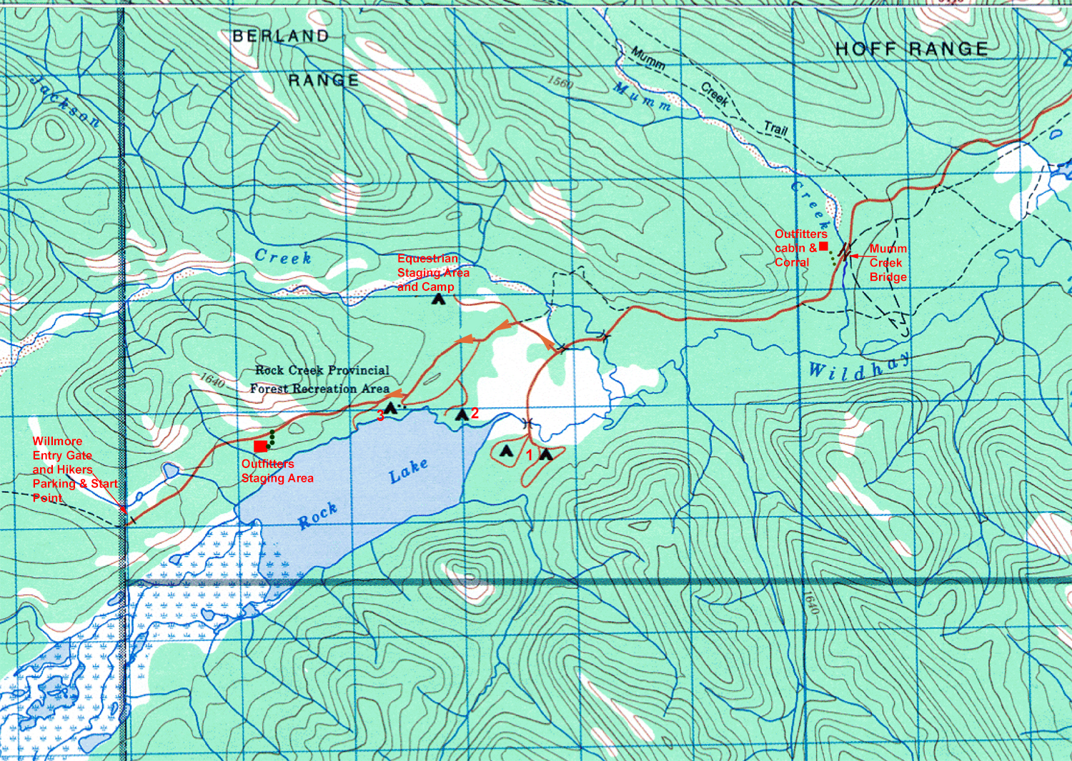
66.9 Sign -> Willmore Wilderness Park Staging Area -- take right turn/fork
67.4 Sign & small road on right: Equestrian Camping [don't go here]
67.8 Sign, left for Windy Bay [stay right; don't go to Windy Bay]
68.6 Sign: Willmore Wilderness Park [go right]
68.9 Sign: Willmore Wilderness Park [straight ahead]
70.5 Sign Equestrian Camping or maybe Outfitters Staging area? If you turn in here, you'll find a large parking area, a biffy, several metal corrals, a watering tank, several picnic tables with firepits, firewood next to the biffy. This is not where we meet.
71.5 About 1 km further up the road at the very end you will enter the trailhead parking lot where we will start our hike and park our cars and meet out outfitter, Kipp Kelley. There you'll find a large parking area, no picnic tables, and at the far end a biffy, garbage cans, and a trailhead sign with a map of Willmore. Hopefully, you'll find my white ford van BYN 192. Park near me.
Camping: There's good camping along the Wildhay River and two areas at Rock Lake. From the staging area, go back down the road and take right turns. One goes to a boat ramp [don't take it]. The others will take you to the camping areas.
| Entry Page | Getting There | Topo Maps | Day Packs | Duffels |
| Bathing, Toilets & Hygiene | Water | Bugs | Blisters | First Aid & Medical Emergencies |