
Looking down to Eagle's Nest Region from Top of Nearby Peak
| Entry Page | Getting There | Topo Maps | Day Packs | Duffels |
| Bathing, Toilets & Hygiene | Water | Bugs | Blisters | First Aid & Medical Emergencies |
Maps
Line of sight orienting works very well with the large features that characterize Willmore. So maps are useful knowing where you are and for getting around, espeically if you plan to do some of your own route finding.
Here are some downloadable and printable map files that I've made that show most of the hikes that Iike in the Eagle's Nest Pass region:
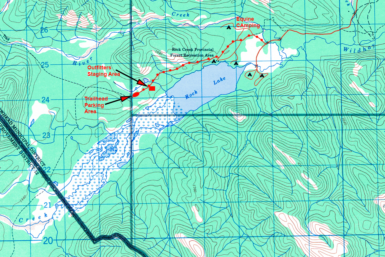
Trailhead to Eagle's Nest Pass Area:
Rock Lake to Eagles Nest
Day Hikes in the Eagle's Nest Pass Region:
Hikes NE side of the Wildhay River
Hikes SW side of the Wildhay River
Rock Lake Camps Near the Trailhead:
http://raysweb.net/willmore_information/images_maps/map_RockLakeCampsTrail.jpg
The topo maps we'll be on are: Rock Lake [83 E8]; Blue Creek [83 E7]; Adams Lookout [83 E10]; Moberly Creek [83 E9]. There's also a good map put out by the Alberta Forest Service and carried by some map shops. You can buy a set in Edmonton or Calgary at a map shop or MEC.
A GPS is handy if you'd really like to know where you are precisely and know how to it in coordination with a topographic map. But it's not necessary and it's extra weight. If you'd like to hike on your own on occasion, I'd recommend one.
Looking down to Eagle's Nest Region from Top of Nearby Peak